Los Altos is not on track to achieve its Regional Housing Needs Allocation (RHNA) lower-income housing production numbers this year or for the current RHNA 4-year cycle running to 2023. A close look the City of Los Altos Housing Element report suggests, there is not enough land zoned such than we can meet the goals for lower-income housing The only good new is that we do produce enough market-rate housing. And that’s because to the State’s way of thinking, a tear down and rebuild of a single family home counts as a “new” house!
Because Los Altos is missing its lower-income housing goals, the City Manager says that as of Jan. 2019 the City will need to be ready for the consequences of SB35. When the City is “in arrears” SB35 allows developers who have a housing project or mixed use project that meets certain criteria to demand an “objective” and expedited 90/180 day approval process depending on the size of the project. [ Now approval typically takes a minimum 1 year to 2+ years.] If our Planning department can’t meet the fast timeline, the City can get taken to court by the developer or a housing advocacy group and is subject to large fines. [Up to $10,000 per unit denied/delayed]. The court can approve the project overruling the City. With this looming…the City is reviewing it’s workflow and paper processes now to be ready for next year.
Table – Showing how little progress
on the 8 year (2023) RHNA goals by income category
…0%, 2%, 5% to 20% of goals

Pink highlight is Total Units built as of last update April 2017; Red highlight is RHNA goals. After 4 years into the 8 year cycle: the City is ~2% towards it Moderate income goal of 112 units, is about 20% towards it Low income goal of 99 units, is about 5% towards its goal of 85 very low income units, and 0% towards its goal of 84 extremely low income units.
Zoning that helps or hurts meeting our RHNA Numbers
Perhaps Los Altos should try harder to meet our RHNA numbers, now that the State will impose real consequences for failure.
A key constraint on meeting our numbers is a lack of land that is zoned by the City at a high enough density [or equivalently, a high enough FAR] to make free-market redevelopments — with “inclusionary” BMR units — pencil out and get built. And besides having restrictive “objective” zoning, many of our regulations and review processes are not objective but are subjective. Projects take a long time to get approvals, and developers may just give up. [Though it was not a housing project, witness the demise of LACI office-parklette proposal.] Subjective City judgements and City foot dragging for proposed housing and mixed use projects are now a No – No per the State Laws like SB 167.
+ The 2010 upzoning of First Street to 45 feet and the similar upzoning of El Camino to 45 feet were intended in large part to meet RHNA numbers. With these two zoning changes, the City was able to demonstrate in its Housing Element report to the HCD, that the City could plausibly see the the promised RHNA units get built by incentivized private developers over the full 8 year cycle. Two highrise condos were built on First Street after 2010 with a handful of BMRs, below market rate units. + + While we were unaware, the State had made one zoning change for us …or to us … the State Density Bonus Law. We were dragged unwillingly, unexpectedly to higher density and height on the 4880 El Camino project, which is now under contruction. + – The 2015 DBC – Downtown Building Committee – in a upswell of citizen aesthetic outrage – without being allowed to consider vibrancy, downtown economics, or the effect on RHNA goals – advised the City Council to downzone First Street back to 30 to 35 feet. Although the Planning Commission rejected the advice, Council agreed and downzoned. The consequence is that now the entire City seems to think ALL the new housing density must be provided exclusively along El Camino. [One exception – the proposal for a subsidized “workforce” housing project on a downtown city-owned parking plaza. Lalahpolitico: I suspect this idea is about as popular as swimming pools at Hillview Park.]The City has a checkered past on zoning changes which were designed at least in part to help us reach our RHNA housing goals using the free-market.
Important!
…the City of Los Altos Housing Element
Land Inventory List
A key component of the RHNA Housing Element report is the City’s land inventory spreadsheet. The State requires the City to identify parcels which are somewhat likely to be redeveloped, and which when redeveloped will do so at a higher density or FAR with more dwelling units. The current report shows the City’s estimate of the number of new dwelling units that could be built per parcel at the current zoning density. [This sheet from 2015 does not take the State Density Bonus into account.]
The new state law AB1397 will require that in the future, the Housing Element inventory report show for each parcel the dwelling units that realistically could be built per designated lower income (LI) levels. Adding the requirement that the City create an inventory on an income level basis – for extremely low, very low, low, moderate, above moderate – will be quite an administrative chore. Furthermore, the new SB 166 requires that if a parcel gets redeveloped for housing at a higher set of income levels than estimated in the Housing Element, other additional sites have to be designated to compensate for that change… continuously!
TABLE: Los Altos Parcels in Housing Element (HE) Inventory

I sorted the City Inventory by Zone to see how much acreage..how many potential dwelling units. I did not bother with the single family home parcels – some are vacant, some are classified as underutilized because the home is on two lots. Almost all these SFH parcels in inventory stand no chance of being upzoned to anything other than SFH and therefore will never be counted for lower income RHNA when redeveloped…unless they add a granny unit of course. Click for larger
Download the spreadsheet in .xlsx 2015-2023_los_altos_Underutilizedhousing_element
Table: Summary of each Zone’s Potential
as reported in City Housing Element report
Downtown Commercial
Sherwood
PUD Village Court
CT ElCamino
DowntownFremont
0.96
2.73
5
9.72
0.61
18
50
176
346
13
Image: The border of City of Los Altos on El Camino
This is an office building on El Camino. It is the east-most El Camino parcel that is located within the boundaries of the City of Los Altos. At current zoning it is estimated in the Housing Element report to accomodate 144 housing units, before a State Density bonus. It is the last parcel within the City borders.
Map Of Los Altos El Camino “High Potential” sites
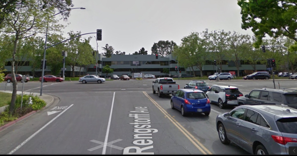
Lots of people erroneously think the the City of Los Altos share of El Camino frontage is much longer than it actually is. Many people realize it starts at the Palo Border right next to but not including the Cabana Hyatt. But where does it end? I used to think it ended at El Monte and included the Panera – Chipotle – CVS shopping center. Actually it ends way before that at Rengstorff, at that nondescript 5150 El Camino office center. {see photo above}
It is obvious that what is included in the Los Altos Housing Element parcels inventory is a very small part of the total land along El Camino. That’s because the City is using it’s judgement as to which parcels have not been recently renovated and have good developer profit potential if privately redeveloped at current zoning regulations. Let’s take a closer look at the El Camino and the CT zone, which are not the same thing. [Note that Village Court is NOT in the CT zone. Nor is the Sherwood-Acacia area. ] The parcels in green are those most likely to be developed and thus included in the Housing Element inventory report. This map is from 2014.

Sites in Green were judged by the City as the most likely to be redeveloped. The city clearly pays attention to when a parcel is listed as “for sale.” That’s probably not the only factor in being assigned a green label. Red sites were recently remodeled or redeveloped.
A very recent City MAP, delineating the CT zone to exclude Village Court. Sherwood was already excluded in the map above.

Notice that Village Court 62-PUD and Chef-Chus/Sherwood (pink) are NOT part of the CT zone. They are zoned at about the half the density or less of the CT zone.
Comparison with our neighbors…
Map Of Mountain View El Camino “Underutilized” sites
The City of Los Altos has kept tabs on development activity in Mountain View across the street on El Camino. Below the Los Altos Housing Element report map shows than much of the El Camino on the Mountain View side is one-story, underutilized and ripe for redevelopment.

Los Altos finds that much of the Mountain View side of El Camino is underutilized at 1 or 2 story.
Image: Mountain View Housing on El Camino

Mountain View El Camino at the Castro intersection. This new housing projects feels like more than 45 feet high.
Map Of Mountain View El Camino New Zoning Heights
The new Mountain View zones allow from 35 feet to 75 feet of height. With the State Density Bonus law applied, the new Mountain View housing going up along El Camino…shown on the map below and what we can see when we drive even further east on El Camino…sure feels taller than 45 feet.

The new Mountain View zoning on their side of El Camino in this section, goes from 35 feet to 75 feet. Perhaps even higher when a developer uses the State Density Bonus. City of MV uses FAR Floor Area Ratio as the key metric to control density, height and bulk. Los Altos has not yet switched to a FAR approach and is still relying on density, setbacks, and envelope…a building envelope approach. Shown is only a subsection of Mountain View’s total El Camino frontage — shown is the MV frontage opposite the City of Los Altos border along El Camino.
Los Altos El Camino from Whole Foods west/up to the Palo Alto border does not seem very ripe for redevelopment. Parcels along here were either recently redeveloped…or are not zoned for high density (for example Village Court and the Sherwood Precise Plan area are at most medium density. Lalahpolitico: This is too low for being within 1/2 mile of “transit hub”)
Our Focus: Current Housing Element Inventory on El Camino
beyond Whole Foods east to Rengstorff – 53 LI units
Lalahpolitico decided to take a closer look at the subsection of El Camino CT zone east of Whole Foods. Why not the whole thing? Because the CT zone subsection west of there is…already heavily redeveloped as Whole Foods/ Colonnade…or is not CT zone( the ChefChu’s/Sherwood Precise Plan Area and the Village Court PUD)…or is recently redeveloped CT zone … [Adobe Animal hospital, 2 hotels, a new condo…]
I used google maps to look up addresses in the 2014 Housing Element inventory. A couple of El Camino parcels in this section have been redeveloped since the report, and I do not include them now as ripe for development. There is not land much left! I have to wonder what can be done to make redevelopment attractive to more of the owners in this subsection of El Camino CT zone.
There is just way too little land to work with to make our lower-income category RHNA numbers work relying on the CT zone parcels in the Housing Element inventory alone – Lalahpolitico
For example, consider that ” for sale” 5150 El Camino site is listed in the City Housing Element report as providing 144 units. Let’s add on a “what-if” density bonus. Suppose the developer decides to build 15% low income units. That means 21 of the 144 units would be low income. That allows a 27.5% density bonus on the 144 units…which is 39 more units. Total units are 183 with 21 as low income.
Let me repeat that the largest site in our HE inventory with 3.8 acres could plausibly generate just 21 more Low Income units towards our goal. If it could happen instaneously today, we’d still be only 40% toward our goal of 99 low income units by Jan. 2022.

Using Google maps, the location of remaining Housing Element report inventory parcels. Google maps locates the 730 Distel parcel outside of the CT zone. Probably Google is wrong.
Besides the 3.8 acre 5150 El Camino site with the potential for 21 LI units, the other sites on the above map amount to about 6.1 acres. So let just extrapolate them to a potential 32 LI units all together. That’s 53 potential LI units for this whole subsection section of El Camino.
I understand that the Housing Element report to the State HCD requires that the City list ONLY those parcels which are “realistic,” aka which are ripe to be redeveloped within the 8 year cycle. Fine. But perhaps we should be preparing for 2 or 3 cycles out? Let’s consider more land area for 30 year change.? How though? See this opinion: Housing shortage: graduated zoning changes are the the answer.
Map – Is there a place for the “Missing Middle” Behind El Camino?

The Housing Element plan is a 8 year cycle. But longer term, say 30 years, is this an area in green and blue that could conceiveably be rezoned, redeveloped for more dense housing? Not just high rises on the 22.75 acres in green, but also “missing middle housing” on the 17.8 acres in blue… buffer zone housing like market rate duplexes, triplexes, townhomes, cluster courts?
Over 30 or 40 years, these ~40 acres above could provide a lot more housing supply if allowed, if incentivized.
On the west subsection of El Camino – not shown – clearly the Sherwood Plan Area and the Village Court PUD there plus a buffer zone there could provide a lot more housing supply if allowed, if incentivized. But how? See opinion: Housing shortage: graduated zoning changes are the answer. This will take decades, not years.
Let’s Look at the Sherwood Part of El Camino
Surprise! Lalahpolitico did not know that the Chef Chus/ Sherwood area along El Camino has had a Sherwood Precise Plan since 1990! I guess it was so successful in refurbishing the entire area there that the City never did another one till Loyola Corners this year.

From the original Sherwood Precise Plan city document. Since 1999 the pink and bright yellow areas became the Colonnade housing development with a new Bev Mo liquor store on the northwest pink corner and a Vitamin shop remaining on the northeast pink corner. The light yellow, brown and blue sections remain little changed … with many aging cottages… except for a new, unappealing condo at the light yellow south tip of San Antonio.
Sherwood Area Housing Element parcels – 15 LI units
Lalahpolitico used google maps to see what Sherwood locations were included in the Housing Element inventory. Only the red and green areas are in the Housing Element inventory. The blue line is the Precise Plan area plus a very ancient office building which IMHO seems ripe for redevelopment..perhaps as mixed used.

The light blue line shows the area that could be considered for sooner and later redevelopment potential. The red and green area are the parts that are in the HE parcel inventory. Only 3 out of 9 acres were tagged as inventory! The green parcel has been redeveloped as a small condo and is almost complete.
These Sherwood sites in Housing Element inventory all together are just 2.73 acres. Recall that the 5150 site on El Camino could provide only 21 lower income units. These Sherwood sites would be lucky to provide 15. But this is area is zoned for lower density than 5150, so it won’t really provide even 15.
Lalahpolitico: What to do? This Precise Plan is ripe for a radical redo. Obviously upzone the whole 9.08 acres. Do something to encourage aggregation of the small lots – graduated density zoning?. Are there 40 owners here? Or through private aggregation efforts over the years, just 5 or 10? Maybe the city can sell roads – Acacia and Sherwood?
Parcels Downtown in Housing Element Inventory – 7 LI units
I don’t know why, but there are no properties on First Street Los Altos which are considered ready to redevelop for housing in the Housing Element inventory report. Instead, the Housing Element report has these six parcels (almost 1 acre) in red lines as high potential. There used to be some historic looking, well kept homes from the 1930s on 2 of them. But they were torn down to provide the required parking for the Packard Foundation Building in around 2012. Funny that no one came forward to argue those old homes should be historic because of their unique architecture.

These parcels amount to 0.96 acre. These 6 downtown parcels in the south part of the triangle are now being used as parking lots. I understand that 5 of the 6 are owned by the Packard Foundation. Many people feel the new Packard Foundation building is the most attractive new development downtown. Many people say they like it because of all the new trees…so many and so tall that now you can hardly see the building.
Lalahpolitico: It’s hard to see the Packard Foundation selling these parcels, unless it is forgiven its parking requirements at its office building nextdoor. Or perhaps the housing project that could be built here has so much underground parking that the Packard Foundation employees can use/lease a floor of it! Even it such a project happened, there might be just 7 low income units (my swag).
Parcels Downtown Commercial zone / Fremont – 3 LI units
There are 3 parcels amounting to .61 acres along Fremont road now used as medical/personal services office. Yes, someday they should look like the medium density housing next door. But this is likely to be almost entirely market rate units, generating just 3 lower-income category units.

Parcels that are Single Family –
60 LI through granny units
In the City Housing Element inventory there are many single family home zoning sites listed as “realistic inventory. I rejected consideration of this whole category of parcels in Housing Element inventory as actually not realistic. Too many are one home occupying two lots. [Lalahpolitico: those single family sites in the inventory spreadsheet are just ~100 useless rows of parcels in the Housing Element spreadsheet. ] In any case, any full-sized 2nd home built on a double lot would be market rate, not low income. It is true that when the City Council probably passes the new ADU ordinance on Feb. 27 , the whole inventory of single family home parcels 10,000 square feet and larger could be put into inventory, perhaps as one row (about 5000 out of 10,000 parcels?) . The idea is that some very small percentage of them will add a granny unit. Perhaps 20 a year, say a total of 60 by the end of this RHNA cycle!?
The City will get RHNA credit for the new granny units. The state HCD will allow the City to do a survey of rents or tenant income on existing granny units, and apply that income composition – extremely low, very low, low, moderate, above moderate – to the new units. At least that’s how its working for the two examples I found: City of Los Altos Hills and unincorporated Marin County.

Photo of page From San Francisco magazine February 2018. Interesting discussion of prices. A list of ADU vendors.
The realistic Lower Income units from
the Housing Element Inventory
just do not add up to meet RHNA income goals
Given the shortfall..given what appear to be the limitations of “inclusionary zoning” in private developments to produce enough units, what can the City do? Perhaps we should permit a “tax credit”project on a donation of city land. A California “tax credit project” is one that that is less than 150 units and is generally a 100% a mix of low-income category tenants. It could also be more specialized such as all low income seniors, or low income veterans, or low income aged-out foster children, etc. Or a mix. It is financed mainly by selling tax credits to corporations and individuals. Of course those tax credits mean the tax-payers do pay for it, but it doesn’t feel like it. Lalahpolitico hopes to write a post on “tax credit projects” in the near future.
Table: Likely actual lower-income units (sum of XLI, VL, L, Moderate)
Downtown Commercial
Sherwood
PUD Village Court
CT ElCamino
DowntownFremont
granny
total
0.96
2.73
5
9.72
0.61
na
na
7
15
0
53
3
60
sum of 138
—
Chances are you never noticed this affordable housing project (tax credit financed) nearby in Mountain View.
Inclusionary Zoning not Enough
therefore “Workforce Housing”?
aka “Affordable Housing”
aka “tax credit project”?
Let me reiterate that in this Lalahpolitico analysis of the City of Los Altos Housing Element Inventory parcels, single family home parcels are excluded, and any El Camino parcels from Village Court to the Palo Alto border are excluded.
The analysis means that of the 362 still unbuilt new BMR units the City has promised to the HCD by 2023, Lalahpolitico estimates at best 148 BMR units are likely to be constructed.
Conclusions:
1. The parcels in the current inventory are only partially “realistic” and the inventory list needs to be recrafted for the 2023- 2031 RHNA cycle.
2. Perhaps citizens should support a “tax credit”project on a donation of City of Los Altos land? Well maybe, but if this is one project is on one downtown parking plaza what will it produce…50 units? 75 units? All lower income tenants of course. We will still be short of our RHNA promises. And some people say downtown is too far from good public transportation and from affordable shopping.
3. Perhaps, rather than a tax credit project, it’s better to ask Council to make quick changes. a) increase the minimum BMR requirement from 10% to 15% b) impose a bmr-in-lieu fee for developers who don’t want to include BMR units; c) impose a housing impact fee on all building permits in the City, except for ADUs or other affordable housing. However, in the RHNA game as played now, in-lieu fees and impact fees don’t count towards meeting RHNA. See Governor candidate Villaraigosa below.
4. Longer term, citizens should pay attention to the RHNA process, the Plan Bay Area process, talk of a transition to regional governance rather than city/county governance, talk of state-wide growth planning, talk of more state level housing laws. Lalahpolitico finds Governor candidate Villaraigosa’s wish list for more housing legislation breathtaking…often in a bad way. Some good things, return of the Redevelopment Agencies, housing teachers on school land, more use of modular construction, regional housing trust funded by money from cities that refuse to build new housing (like we could refuse here in Los Altos) See the San Jose Mercury.

Local city governments send a council member to ABAG General Assembly meetings. Lalahpolitico: But ABAG seems to be actually steered by movers and shakers in our local “Affordable Housing Industry complex.” Like in so much of modern life, technocrats seem to be in charge. Perhaps that is inevitable.
Lalahpolitico last word:
Regional vs. State Growth Plan
Fix for Poverty?
I find talk of moving to regional governance here is Bay Area rather frightening since it would apparently be the Metropolitan Transportation Commission and Association of Bay Area Governments in charge. [That is just transit and housing planners; and I understand that 2 years ago there was a kind of unfriendly merger where transit won. ] What about controlling the growth of and location of new of jobs? Where is the integration of planning for water, non-transit infrastructure and schools as infill occurs? With those elements missing, the planning for infill development is going to be inadequate.
Perhaps it would better to just skip the regional step and pursue a state level “Growth Management Plan” similar to the somewhat basis one they have in State of Washington. But it would need to discuss zoning and budgeting for population, jobs, housing, transportation, water, other infrastructure, schools, agriculture, open space.
I find that talk of how “this and that” one thing will alleviate poverty rings so hollow. Housing a homeless person will end their poverty. Pre-school education will cure poverty. Owning a home lifts a person from poverty. A college degree will cure poverty. Subsidized rent alleviates poverty. Free health care will cure poverty. Faith in God(s) will cure poverty. Domestic violence intervention will reduce poverty. Removing lead paint will cure poverty. Free birth control/”choice” will alleviate poverty. Female job equality will cure poverty. There are so many special interests and PhDs in involved in these “helping industries” it makes my head spin. All good causes…but one by one…just band aids.
Check out a partial roster of participants in the our local Affordable Housing Industry Complex here. The CASA Technical Committee Members are especially interesting.