
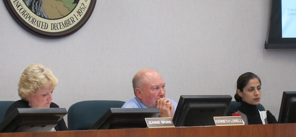
The Los Altos City Council has been thinking about increasing the amount of documentation required for plans of major commercial projects. It seems that Council and Los Altos Planning Commissioners need more help in visualizing what a project will look like. Lalahpolitico thought another goal was to offer a natural view of what the proposed project would look like to the naked eyes of a human walking on the sidewalks or driving on the street. And sharing that view with the public-at-large. That’s government transparency.
Based on the July 24 council meeting discussion, the direction to the Planning Commission is to look at requiring developers to submit one or more montages, also called photo simulations. Using 3-D modeling to create the montage is not going to be required, but we observe it can help increase accuracy of perspective views of the project.
“A montage image is produced by superimposing a perspective image of a building on to a photographic background. Care is needed to record the position from which the photograph was taken, and to generate the perspective using the same viewpoint. This technique is popular in computer visualisation, where the building can be photorealistically rendered, and the final image is intended to be almost indistinguishable from a photograph.” [Source: Wikipedia on standard architectural documents.]

Figure 1: This photo montage was submitted to planning as promotional material
LALAHPOLITICO TRYS TO RECREATE THE ABOVE REPRESENTATION – Could kinda
The above photo simulation of the Enchante Hotel was submitted by the developer. I decided to to see if I could figure out where the photo was taken from, and if the perspective was normal to the human eye. I went to the building at 1 Main Street and peered through my Nikon camera with the lens set a normal focal length of 50mm. I walked around till I found spot close to curb almost at the cross walk crossing Edith. I was trying to get the three orange spiky plants in the median as a point of reference to look about the same.
I think I stood in almost the right spot. To simulate my human vision, stereo vision, which is a little broader left and right than a camera viewport, I shot 3 pictures and used Photoshop to stitch them together. The picture below of the corner is what is feels and look like to me as fix my gaze at the at a center point.
The picture below of the corner is what is feels and look like to me as fix my gaze at the at a center point.

Figure 2: 3 shot panorama. What the corner looks like from Lalahpolitico’s eyes, from 1 Main Street, corner of Edith
Now Compare Figure 2 with Figure 3
Gee, that sure seems very different from Figure 1. But look below at Figure 3 and you will see that Figure 2 is pretty similar to Figure 3. Notice that the height of the yield sign is now the same. The size of single story hair salon neighbor on Main Street is more similar. The size of the realtor building on San Antonio is more similar, as are the sizes of the two trees on the far left and the far right of Figures 2 and 3.
DIGRESSION – Mansard vs. Spanish neocolonial
Too bad this hotel couldn’t coordinate with the barrel-tiled realtor building across the street. Gosh knows the architect, Abby Ahrens, does beautiful neo-spanish colonial reproductions. Why, why, why did she choose Mansard? We speculate here’s why. If the height limit downtown was more like 40 feet, she could have built her 3-story hotel with a nicely slopped barrel tile roof. I have seen many new, small, successful hotels in the spanish style – eg., downtown Palo Robles. Too bad we now have this wedding cake. [ In case you didn’t know, a 2 story 10 room hotel on this lot would not be economically viable.]
If the height limit downtown was more like 40 feet, she could have built her 3-story hotel with a nicely slopped barrel tile roof
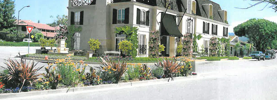
Figure 3: This is just a crop of Figure 1. It is more natural for your eyes and brain to see this, even with peripheral vision
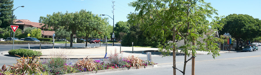
FIGURE 3 IS HOW IT REALLY WILL LOOK TO A HUMAN STANDING THERE
This will be how it feels to stand there. The hotel feels substantial, big even. If you don’t just look straight ahead, but now also look down you will see all the extra pavement depicted in Figure 1. If you then also look up, you will see all the extra sky as depicted in Figure 1. Figure 1 creates the illusion of greater distance between the planned Enchante Hotel and the Ron Packard law Offices. All the extra pavement and sky makes the Enchante Hotel look small relative to the whole super-sized scene in Figure 1. But the hotel doesn’t really feel as small as portrayed in Figure 1.
All the extra pavement and sky makes the Enchante Hotel look small relative to the whole super-sized scene. But the hotel doesn’t really feel as small as portrayed in Figure 1
However, Figure 1 is in a lot of senses accurate. Just not truly at the scale of the human naked eye. All I had to do was crop the big photo and I was able to created what I really SAW with my naked eyes, with normal peripheral vision, standing at the corner. What I saw during my test was Figure 2, and I predict Figure 3 is what I will see when the project is erected.
What I saw during my test was Figure 2, and I predict Figure 3 is what I will see when the project is erected.

Figure 4: The hotel fireplace will be a prominent feature from this view
HOW WILL IT LOOK HEADING SOUTH ON SAN ANTONIO
Taken standing at the corner with the normal 50mm lens which shows things as the size seen by the naked eye, in Figure 4 one can see that the mass of the hotel will be a big part of your view. The first floor is 10 feet tall which is the height of that yield sign. We tried to make the other floors shorter, but the building will be blocking a view of the hills, which apparently bothers some people. I don’t mind if it increases downtown vibrancy.

Figure 5: Photo Montage of Third Street Project – brutally modern?
ARCHITECT’S PHOTO MONTAGE OF THIRD STREET PROJECT
The photo part is the Japanese restaurant on the left in Figure 5. The hand drawing on the right of the montage presumably tries to be from the same perspective and vantage point as the photo. I had been in the south parking plazas quite a few times recently and never had experienced any view of the now nearly finished project that looked anything like this montage. So I went to seek it out.
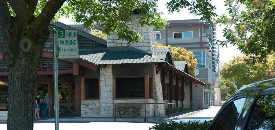
Figure 6: Standing out in the restaurant parking lot…to get the same view point as drawing
First I went to a spot where I could see the corner of the Third Street building from the same perspective as in the architect’s drawing. I think the above Figure 6 is real close. The photo is shot with the normal 50mm lens and I am standing about 100 feet away almost out on San Antonio Road. If I went out to the road, the trees would further obscure the building. There was no view of the left side of the offices or of the Japanese restaurant from this vantage pint. Why? Oh, it’s the big restaurant in front.
Oh, the view is blocked by the big restaurant in front.
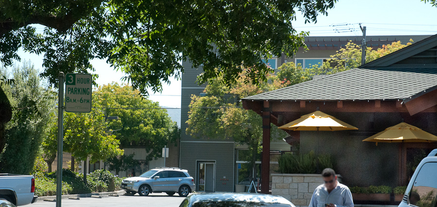
Figure 7: this side is also blocked by restaurant and trees
I went to see if I could get a shot of the Japanese restaurant as show in Figure 5. I think I got pretty close here in Figure 7 by moving my location six or so parking spaces, still almost out to San Antonio Road. Clearly in the summer, the trees block most of the view of the Third Street office building.

Figure 8: The view most like the drawing is when standing in the far lot near restaurant trash area
Moving still further south in the restaurant parking lot, I was able to see this view in Figure 8, which to me seems most like the intent of Figure 5 – brutally modern. However I can’t see the Japanese restaurant and I can see the garbage and service area of the restaurant. If I move still further south, the office building will be blocked again. Bottom line, there is a viewport of about 25 feet wide, in the most avoided part of the parking lot, where the office building looks austere like above.
there is a viewport of about 25 feet wide, in the most avoided part of the parking lot, where the office building looks austere like above
Unlike with the Enchante montage, we found that the scale of Third Street project was rendered close to how a human would see it with unaided eyes, from the vantage point shown in the Figure 5. Notice there is NOT a lot of extraneous sky and pavement in Figure 5.
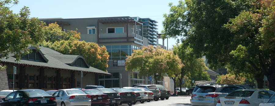
Figure 9: Here is a view you will actually SEE when you drive into the lot from San Antonio
Figure 9 a a real view a lot of people will experience driving into this parking lot, or using it as an alternative to driving on Main Street. The Third Street office building looks definitely modern, but stylishly so. Sort of a harking back to the 60’s. How cool it that.
The Third Street office building looks definitely modern, but stylishly so. Sort of a harking back to the 60’s. How cool it that.
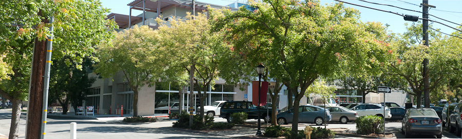
Figure 10: Here is another view you will actually SEE when you want down Third from Chase Bank
And here is yet another real human view of the Third Street Offices. [It’s 3 normal shots to form a panorama.] Just walk down from the Chase Bank and you’ll experience this view. Right now all the trees are blocking the splendid modern detailing on this, the north side of the building, it’s best side in my opinion. I look forward to seeing more of the building in the winter when the trees are bare.
LALAHPOLITICO EDITORIAL COMMENT:
We are all for getting some photo simulations of major projects done. But please don’t hoard all the photo simulations at City Hall. Share them with the public. Give us government transparency.
Right now, planning documents of the large commercial projects are only available to view by the public on paper at City Hall. Sometimes the City graces Los Altos Town Crier with one drawing of a proposed project to run with a story. Wow. A little 5 by 4 or smaller drawing on newsprint. Or a citizen might catch a glimpse the drawings if he watches the tapes of Plannning Meetings — on a little 2 by 3 inch screen!. But often the camera operator can’t capture the drawings shown during a meeting, especially when on poster board displays. The current City practice, though legal of course, is not transparent and does not meet the expectations of information devouring Los Altans.
Two years ago Malika Junaid, Planning Commissioner, cajoled the city into delivering planning document packets 100% electronically to commissioners. She said this replaced heavy 5 inch binders of paper. It should be easy to pluck out photo simulations of 4 sides of a project out of an electronic packet and to post them to the city web site. The public does not need to see Ms. Junaid’s whole packet. After all, the City has posted plans for the Safeway project, but why ONLY for the Safeway project is hard to understand. Let the developer use these photo simulation techniques to try to express what her project will feel like at the human street level to the naked eye, in the existing setting. That could go a long way to dispelling (or confirming) public fears.
But please don’t hoard all the photo simulations at City Hall. Share them with the public. Post them on the City web site. Be transparent.
[…] Government Transparency of Planning Applications […]